Door categorieën bladeren
Nederlands
$
USD
Koppel je AI aan Fiverr


_compressed_durxys.jpg)
Automatische vertaling
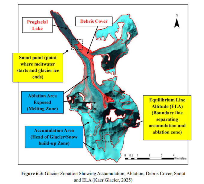
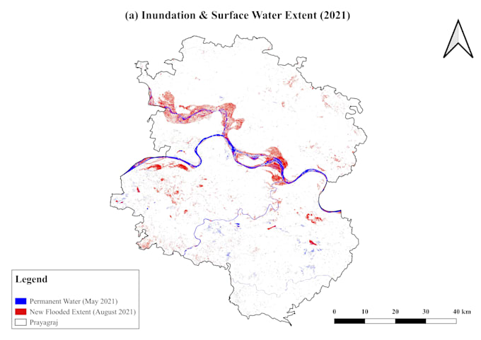
Welkom! Ik bied oplossingen voor Geographic Information Systems (GIS), Remote Sensing en ruimtelijke data-analyse met hoge nauwkeurigheid, op maat gemaakt voor jouw academische, milieuproject of zakelijke behoeften.
Wat ik aanbied:
GIS-kaart maken: thematische kaarten, choroplethkaarten, ruimtelijke digitalisering, georeferentie en lay-out ontwerp.
Remote Sensing & satellietbeeldverwerking: supervised/unsupervised classificatie, Landgebruik/Landbedekking (LULC) en NDVI-vegetatiegezondheidsmonitoring.
Ruimtelijke & terrein-analyse: Digital Elevation Model (DEM) verwerking, waterscheidingsafbakening, hellingshoek/oriëntatie berekening, contouring en buffer/nabijheidsmodellering.
Multi-sensor integratie: verwerking van optische, SAR en thermische datasets met Google Earth Engine (GEE), ArcGIS, QGIS, ERDAS Imagine en SNAP.
Leveringen:
Kaarten klaar voor publicatie (PDF, PNG, JPEG, TIFF)
Ruwe geospatiale bestanden (Shapefile, GeoJSON, KML/KMZ, GeoTIFF)
Schoon methodologie slides/documentatie (PPT/PDF)
Neem contact met me op voordat je een bestelling plaatst om de projectvereisten te bespreken!
Remote Sensing and GIS Specialist, GEE, Environment Science
Talen
Automatische vertaling
Automatische vertaling
Met welke software werk je?
Ik gebruik voornamelijk ArcGIS, QGIS, Google Earth Engine (GEE), ERDAS Imagine, SNAP en Python voor maatwerk ruimtelijke verwerking.
Welke bestandsformaten zal ik ontvangen?
Je ontvangt hoge-resolutie kaartoutputs (PDF, PNG, JPG) samen met ruimtelijke datasets in Shapefile (.shp), GeoJSON, KML/KMZ of GeoTIFF formaten.
Kun je werken met ruwe satellietgegevens of aangepaste coördinaten?
Ja, ik kan Sentinel, Landsat, MODIS of SRTM DEM-gegevens downloaden en verwerken, evenals je aangepaste GPS-coördinaten en CSV/Excel-tabellen plotten.