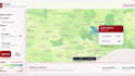
Ik maak gis-kaarten ruimtelijke analyse en datadashboards

P
peterboateng06
P
peterboateng06
PETER BOATENG
Sommige informatie is automatisch vertaald.

Over deze dienst

Automatische vertaling

Stuur me je locatiegegevens, veldgegevens of satellietbeelden, en ik zet ze om in overzichtelijke GIS-kaarten, ruimtelijke analyses of remote sensing visuals die je kunt gebruiken voor rapporten, presentaties, onderzoek of planning.

Maak kennis met PETER BOATENG

PETER BOATENG

GIS Mapping, Spatial Data and Dashboard Specialist

  • Afkomstig uitGhana
  • Lid sindsaug 2021
  • Talen

    Engels
I help clients turn messy location and programme data into clear maps, dashboards and reports. I work with QGIS, ArcGIS Pro, Google Earth Engine, KoBoToolbox, Excel, MapLibre and Chart.js. My work covers GIS mapping, spatial analysis, remote sensing, data cleaning, field data forms, web maps and evidence packs. I have supported projects in public health, urban planning, transport safety, environmental risk and donor-funded programme delivery. Clear data, clean visuals and reliable communication are what I focus on.

Automatische vertaling

Mijn portfolio