Door categorieën bladeren
Ontdekken
Fiverr Pro
Nederlands
$
USD


Automatische vertaling
Hallo, ik ben Hassan, een GIS-expert met uitgebreide ervaring in Land Use/Land Cover (LULC) classificatie. Ik bied professionele en nauwkeurige LULC-classificatieservices met behulp van geavanceerde GIS- en remote sensing-technieken.
Wat ik aanbied
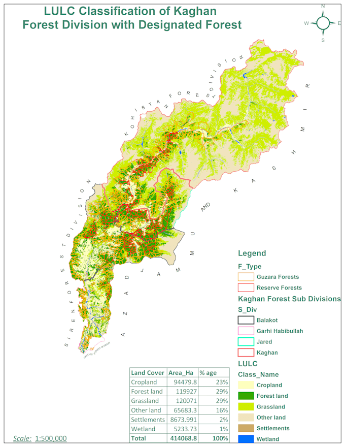
· Hoge kwaliteit LULC-classificatie met satellietbeelden
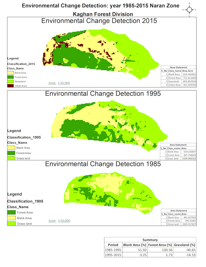
· Multi-temporale LULC-analyse
· Gedetailleerd rapport en visuele weergave (kaarten, grafieken)
· Aangepaste analyse op basis van klantwensen
· Data preprocessing en post-processing
Tools die ik gebruik
· Ik gebruik industry-standard software zoals ArcGIS, QGIS en Imagine voor nauwkeurige en betrouwbare resultaten
Waarom voor mij kiezen
· Met een sterke achtergrond in GIS en remote sensing zorg ik voor precieze en gedetailleerde LULC-classificaties. Mijn toewijding aan kwaliteit en klanttevredenheid onderscheidt mij.
GIS specialst A Map maker
Talen
Automatische vertaling
Automatische vertaling
Wat is LULC-classificatie?
LULC (Land Use/Land Cover) classificatie is een proces dat wordt gebruikt in Geographic Information Systems (GIS) en remote sensing om de fysieke kenmerken en het gebruik van land te categoriseren en in kaart te brengen.