Ik doe spatial analysis en gis mapping in arc gis en qgis

Q
qamarmohoudeen
Q
qamarmohoudeen
Qamar Ud Din
Sommige informatie is automatisch vertaald.

Over deze dienst

Automatische vertaling

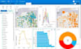
Ik bied professionele GIS-diensten aan, waaronder parcelendigitalisering, LULC-mapping, spatial analysis, remote sensing en het maken van kaarten van hoge kwaliteit. Ik gebruik ArcGIS en QGIS om nauwkeurige, goed gestructureerde geospatiale data te leveren in formaten zoals SHP, KML, GeoJSON en PDF. Mijn werk zorgt voor precisie, snelle levering en schone, kant-en-klare kaarten voor jouw projectbehoeften.

Maak kennis met Qamar Ud Din

Qamar Ud Din

GIS ANALYST

  • Afkomstig uitPakistan
  • Lid sindsdec 2022
  • Talen

    Engels
Hi! I’m Qamar ud Din, a passionate GIS Analyst with hands-on experience in spatial data analysis, mapping, and geospatial solutions. I specialize in turning complex geographic data into clear, actionable insights that help businesses and organizations make informed decisions. I offer professional services including: GIS mapping and visualization Satellite and drone imagery analysis Spatial data digitization and editing Geospatial data processing and analysis (ArcGIS, QGIS) Custom maps for reports, presentations, and projects

Automatische vertaling

Gerelateerde tags