Door categorieën bladeren
Ontdekken
Fiverr Pro
Nederlands
$
USD


Automatische vertaling
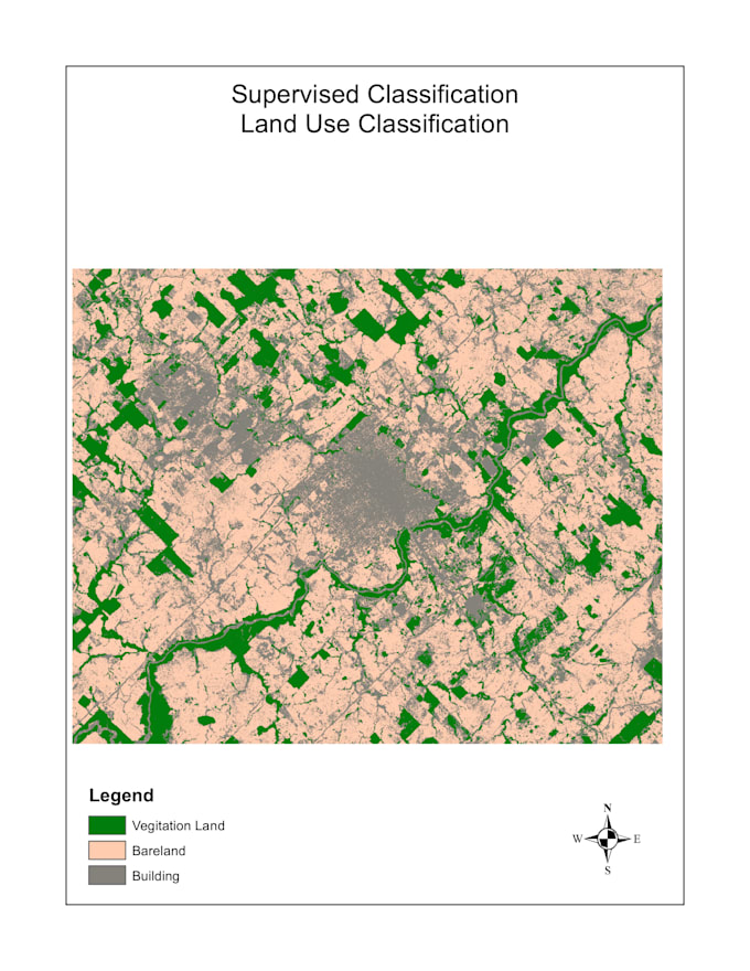
Ben je een onderzoeker, student, NGO of milieudeskundige die een professionele LULC-kaart nodig heeft?
Ik classificeer satellietbeelden (Landsat 8/9 of Sentinel-2) en lever een publicatieklare kaart met legenda, schaalbalk en noorderpijl.
Geleide of niet-geleide classificatie
Precisie beoordeling (confusiematrix + Kappa-coëfficiënt)
Geleverd in PDF, PNG of GeoTIFF
Voor elke regio ter wereld
Workflow in ArcGIS Pro of Google Earth Engine
Ik ben een MSc-student in GIS & Remote Sensing met actieve onderzoekservaring in multi-temporale satellietbeeldanalyse.
Neem contact met me op voordat je bestelt als je een specifiek studiegebied of deadline hebt. Ik bevestig altijd eerst de haalbaarheid.
GIS and Remote Sensing Specialist
Talen
Automatische vertaling
Automatische vertaling
Welke satellietgegevens gebruik je?
Ik gebruik Landsat 8/9 of Sentinel-2 beelden afkomstig van Google Earth Engine of USGS Earth Explorer.
Kun je elke locatie ter wereld in kaart brengen?
Ja, zolang er cloudvrije beelden beschikbaar zijn voor jouw studiegebied en tijdsperiode.
Welk bestandsformaat ontvang ik?
Standaard in PDF en PNG. GeoTIFF op aanvraag beschikbaar.