Door categorieën bladeren
Ontdekken
Fiverr Pro
Nederlands
$
USD

Automatische vertaling
Nodig je professionele GIS-mapping, cartografie, digitale kaartvorming, AI-aangedreven WebGIS of geospatiale automatisering nodig? Ik help bedrijven, ingenieurs, architecten, stedelijke planners, landmeters, onderzoekers, milieu-wetenschappers, boeren en overheidsinstanties geografische data om te zetten in bruikbare inzichten.
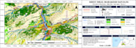
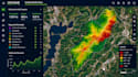
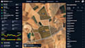
Mijn diensten omvatten ArcGIS, QGIS, ruimtelijke analyse, geospatiale dataverwerking, satellietbeeldanalyse, drone-mapping, remote sensing, interactieve webkaarten, GIS-dashboards, AI GIS-oplossingen, thematische mapping, landgebruik en landdekkingsmappings, en geospatiale geautomatiseerde processen.
Of je nu locatie-intelligentie, terrein kaartvorming, geschiktheidsanalyse voor locaties, infrastructuurplanning, milieubewaking, landbouwkaartvorming of maatwerk WebGIS-ontwikkeling nodig hebt, ik pas de oplossing aan jouw project aan.
Ik verwelkom klanten uit de VS, VK, Canada, Australië, Duitsland, Frankrijk, Europa, Azië en wereldwijd.
Waarom voor mij kiezen?
Stuur je projectvereisten, studiegebied, beschikbare data en gewenste output.
WebGIS Developer
Talen
Automatische vertaling
Automatische vertaling
Welke GIS-mapping- en geospatiale diensten bied je aan?
Ik bied GIS-mapping, cartografie, ArcGIS, QGIS, ruimtelijke analyse, satellietbeeldanalyse, drone-mapping, remote sensing, digitale kaartvorming, interactieve WebGIS, GIS-dashboards en geospatiale data-automatisering.
Kun je maatwerk WebGIS-toepassingen en GIS-automatiserings-workflows maken?
Ja, ik kan interactieve kaarten en WebGIS-oplossingen op maat ontwikkelen, samen met geschikte geospatiale data-verwerking en automatiseringsworkflows op basis van jouw projectvereisten.
Moet ik zelf GIS-gegevens of satellietbeelden aanleveren?
Je kunt jouw eigen shapefiles, GeoJSON, CSV, rasterbestanden, dronebeelden of satellietdata aanleveren. Als je geen data hebt, vertel me jouw studiegebied zodat we geschikte bronnen en beschikbaarheid kunnen bespreken.
Wie kan profiteren van jouw GIS- en digitale kaartvormingsdiensten?
Ik werk met onderzoekers, studenten, landmeters, ingenieurs, architecten, stedelijke planners, milieu-wetenschappers, landbouwprofessionals, vastgoedbedrijven en organisaties wereldwijd.
Welke opleveringen ontvang ik en kun je maatwerkprojecten aan?
Afhankelijk van je pakket kunnen opleveringen bestaan uit hoogwaardige GIS-kaarten, exporters in PDF of PNG, bewerkbare ArcGIS- of QGIS-bestanden, ruimtelijke analyse-resultaten of een interactieve WebGIS-oplossing. Neem contact op voordat je complexe drone-mapping, AI- of automatiseringsprojecten bestelt.


