Ik breng grondwaterpotentiaalzone in kaart

S
s_uroojfatima
S
s_uroojfatima
Urooj Fatima
Sommige informatie is automatisch vertaald.

Over deze dienst

Automatische vertaling

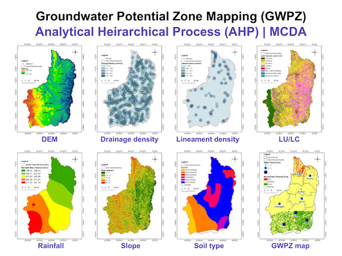
Als milieugeograaf gespecialiseerd in GIS, maak ik kaarten van Groundwater Potential Zone (GWPZ) met behulp van Remote Sensing, GIS en hydrogeologische parameters. Deze kaarten zijn essentieel voor waterresourceplanning, boorputboringen, irrigatie en duurzame ontwikkeling.


Wat ik aanbied:

️GWPZ in kaart brengen op basis van belangrijke factoren:

  • Landgebruik / Landbedekking
  • Hellingshoek
  • Geologie
  • Grond
  • Drainagedichtheid
  • Neerslag of Recharge
  • Lineamentdichtheid


-️ Gewogen overlay of AHP-gebaseerde analyse

-️ Kaarten met hoge resolutie in PDF/PNG/GeoTIFF

️- Aangepaste legenda, schaalbalk, noordpijl

️- Professionele samenvatting van het rapport (indien nodig)

Maak kennis met Urooj Fatima

Urooj Fatima

Environmentalist, Ecologist, Climate Analyst

  • Afkomstig uitPakistan
  • Lid sindsjul 2023
  • Gem. reactietijd1 uur
  • Talen

    Urdu, Engels
ENVIRONMENT | SUSTAINABILITY | ECOLOGY | CLIMATE | FOREST: EIA, IEE, EMP & environmental compliance, Biodiversity, ecological & habitat restoration, BNG, arboriculture & landscape design, Carbon stock, footprint & climate analysis, ESG reporting (GRI, IFRS, SDGs) & blue carbon, GIS & spatial analysis (ArcGIS, QGIS, GEE), Remote sensing (Landsat, Sentinel, MODIS), LULC classification & change detection, Statistical analysis (SPSS, R, Excel, OriginPro), Regression, correlation, PCA & spatial statistics. SECTORS I SERVE: Forest | Ocean | Water | Land | Coastal | Marine | Freshwater

Automatische vertaling

Mijn portfolio

Andere Datavisualisatie diensten die ik aanbied

Gerelateerde tags