Door categorieën bladeren
Ontdekken
Fiverr Pro
Nederlands
$
USD


Automatische vertaling
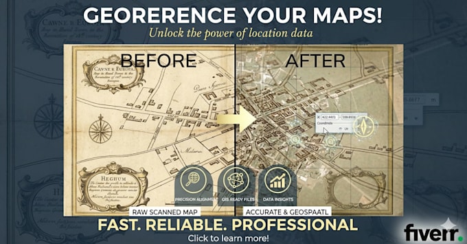
Ik georefereer je kaarten, gescande tekeningen, dronebeelden, luchtfoto's en rasterdatasets professioneel met ArcGIS.
Deze service is ideaal voor:
Wat je ontvangt:
Ik ben een professionele hydrographische en geospatiale specialist met geavanceerde expertise in GIS en GNSS data verwerking.
Ik zorg voor precieze, betrouwbare en professionele resultaten.
GNSS and Hydrographic data processing expert
Talen
Automatische vertaling
Automatische vertaling
Wat is Georeferencing
Georeferencing is het proces waarbij echte geografische coördinaten (breedte/longitude of projectiesystemen) worden toegewezen aan rastergegevens (gescande kaarten, luchtfoto's) of vectorgegevens, zodat ze binnen GIS-software kunnen worden bekeken en geanalyseerd.
Welke soorten bestanden kan je georefereren?
Ik kan gescande kaarten, satellietbeelden, luchtfoto's, dronebeelden, rasterdatasets en technische tekeningen georefereren. Ik lever outputs die compatibel zijn met ArcGIS, waaronder GeoTIFF, TIFF, JPEG en andere benodigde formaten.
Hoe nauwkeurig zal de georeferentieerde data zijn?
Je bestanden worden georefererd met hoge positiebewustheid met behulp van ArcGIS-tools. Ik zorg voor het juiste coördinatensysteem (bijvoorbeeld WGS84, UTM) en een goede uitlijning, zodat je raster of kaart betrouwbaar kan worden gebruikt voor GIS-analyse, mapping of surveywerk.
