Door categorieën bladeren
Ontdekken
Fiverr Pro
Nederlands
$
USD

Automatische vertaling
Ik ontwikkel maatwerk GIS-tools, ArcGIS-scripts en QGIS-plugins die aansluiten bij jouw geospatiale behoeften. Of je nu Python GIS-automatisering, ruimtelijke analysetools of een volledig geavanceerde geoprocessing-applicatie nodig hebt, ik lever snelle, professionele en betrouwbare oplossingen.
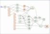
Met expertise in ArcPy, PyQGIS, GDAL/OGR en andere GIS-bibliotheken, maak ik tools die workflows automatiseren, raster- en vectorgegevens verwerken en nauwkeurige, efficiënte resultaten bieden.
Diensten die ik aanbied:
Waarom voor mij kiezen?
Professionele ervaring in GIS-software ontwikkeling
100% op maat gemaakte tools voor jouw workflow
Schoon, geoptimaliseerd en gedocumenteerd code
Uitstekende communicatie en support
Snelle en betrouwbare levering
Wil je een GIS-tool, ArcGIS-script of QGIS-plugin dat tijd bespaart en de productiviteit verhoogt? Neem vandaag nog contact op om te beginnen.
GIS Automation and Deveopler
Talen
Automatische vertaling
Automatische vertaling
Ondersteun je GIS-platforms?
Ik werk met ArcGIS Pro, ArcMap, QGIS en standalone Python-gebaseerde GIS-toepassingen.
Kan ik mijn bestaande GIS-workflow automatiseren?
Ik kan handmatige workflows omzetten in geautomatiseerde scripts of tools om je tijd en moeite te besparen.
Moet ik data aanleveren?
Als het mogelijk is, ja. Het aanleveren van voorbeeldgegevens helpt me om te testen en te zorgen dat de tool perfect werkt voor jouw behoeften.
Kun je tools maken met een gebruiksvriendelijke GUI?
Absoluut. Ik kan desktop GIS-tools bouwen met GUI met PyQt5, zodat ze makkelijk te gebruiken zijn zonder programmeerkennis.
Kan ik mijn GIS-tool integreren met een database of API?
Ja, ik kan tools verbinden met PostGIS, MySQL of externe APIs voor geavanceerd beheer van geospatiale data.


