Door categorieën bladeren
Nederlands
$
USD
Maak verbinding met je AI

Automatische vertaling
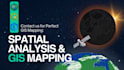
Ontgrendel geospatiaal potentieel!
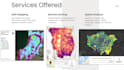
Met meer dan 7 jaar expertise bied ik op maat gemaakte GIS-oplossingen die aan jouw behoeften voldoen:
1. GIS-analyse: Levering van nauwkeurige inzichten voor weloverwogen beslissingen.
2. Web GIS-toepassingen: Creëren van dynamische kaartoplossingen voor verbeterde visualisatie.
3. Kaartmaken en cartografie: Visueel aantrekkelijke representaties voor effectieve communicatie.
4. Sateliet- en dronebeelden: Waardevolle inzichten halen uit luchtbeelden.
5. terrein-analyse: Gedetailleerde inzichten in landschapdynamiek en geomorfologie.
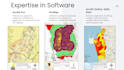
6. Expert tools: Bedreven in het gebruik van ArcGIS voor uitgebreide geospatiale analyse.
Expertise software,
Laten we samenwerken om het volledige potentieel van jouw geospatiale projecten te ontsluiten!
Talen
Automatische vertaling


