Sommige informatie wordt in het Engels weergegeven.
Over mij
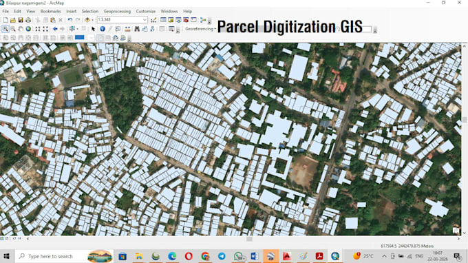
I am a professional land and mining surveyor with 25+ years of field and mapping experience. I specialize in:
- Map georeferencing (Topo sheets, old survey maps, scanned maps)
- DGPS point plotting on GIS maps
- Satellite image referencing
- CAD to GIS conversion
- Digitization of raster maps into shapefiles/KML
I use Global Mapper, ArcGIS and AutoCAD for precise, professional results.
Let’s work together on your GIS, forest, mining or land survey-related projects. On-time delivery and quality output is my promise!
... Lees meer
s
Sanjeev K
offline •
Bekijk mijn diensten
Vector tracing
I will do gis digitization in arcgis, georeference map and create shapefile cad to gis