Ik voer remote sensing en satellietbeeldanalyse uit in Google Earth Engine

S
smas_gis
S
smas_gis
Muhammad Ali

Level 2

Sommige informatie is automatisch vertaald.

Over deze dienst

Automatische vertaling

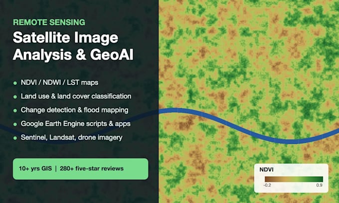
Maak van satelliet- en dronebeelden kaarten, cijfers en beslissingen. Ik combineer remote sensing met machine learning (GeoAI) om resultaten te leveren die je kunt gebruiken, met code die je opnieuw kunt draaien. **Diensten** - Vegetatie- en waterindices: NDVI, EVI, NDWI, NDBI, landoppervlaktetemperatuur - Landgebruik/landdekkingsclassificatie (Random Forest, SVM, deep learning) - Veranderingen detecteren: stedelijke groei, ontbossing, overstromingsgebied, gewasmonitoring - Kenmerkextractie: gebouwen, wegen, zonnepanelen en bomen uit beelden - Geschiktheids- en risicokartografie (overstroming, bosbrand, hitte) met multi-criteria-analyse en ML - Google Earth Engine-scripts en -apps, time-series analyse Data: Sentinel-1/2, Landsat, MODIS, PlanetScope, dronebeelden, DEM/SRTM Tools: Google Earth Engine, Python (Rasterio, scikit-learn, PyTorch), ArcGIS Pro, QGIS, SNAP Je ontvangt hoogkwaliteit kaarten, gebiedsstatistieken (CSV/Excel), GeoTIFF/shapefile-uitvoer en het gebruikte script.

Maak kennis met Muhammad Ali

Muhammad Ali

GIS Analyst and Web GIS Developer, ArcGIS Pro, QGIS, Leaflet, GeoAI

5,0(287)

Level 2

  • Afkomstig uitPakistan
  • Lid sindsdec 2016
  • Gem. reactietijd1 uur
  • Laatste levering3 weken
  • Talen

    Urdu, Engels, Punjabi
Level 2 GIS developer with 10+ years, 357 completed Fiverr orders and a 5.0 rating. I turn location data into maps, analysis and apps your team can use: GIS mapping and spatial analysis in ArcGIS Pro and QGIS, site suitability, georeferencing and digitizing, web GIS apps with Leaflet, Mapbox and PostGIS, ArcGIS Online and Experience Builder, and remote sensing in Google Earth Engine. I also build AI agents and n8n automations. Send your area, data, output and deadline, and I'll reply within an hour with a clear scope and price.

Automatische vertaling

Mijn portfolio