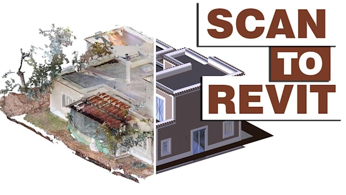
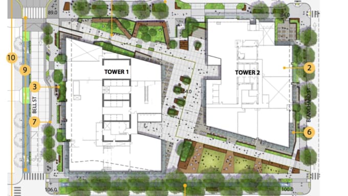
site planning, land development and point cloud to cad expert
Verenigd Koninkrijk
Engels
Sommige informatie wordt in het Engels weergegeven.
Over mij
hello, i am a professional site planner and cad designer with expertise in subdivision site plans, master planning, and land development design in 2d and 3d. i also convert point cloud scans from matterport, navvis, leica, and geoslam into accurate revit and autocad models. i deliver clear, detailed, and ready-to-use drawings for presentation, approval, and construction. i focus on practical solutions, fast delivery, and reliable communication.... Lees meer