Door categorieën bladeren
Nederlands
$
USD
Maak verbinding met je AI

Automatische vertaling
GIS and Remote Sensing Analyst, Maps, Satellite Imagery, Power BI
Talen
Automatische vertaling
Automatische vertaling
Wat heb je van mij nodig om te beginnen?
Jouw data (shapefiles, Excel met coördinaten, KML, enz.) of een beschrijving van wat je nodig hebt, het gebied van interesse en het doel van de kaart. Als je geen data hebt, kan ik openbare bronnen zoals satellietbeelden of OpenStreetMap gebruiken.
Kun je werken met ArcGIS-bestanden?
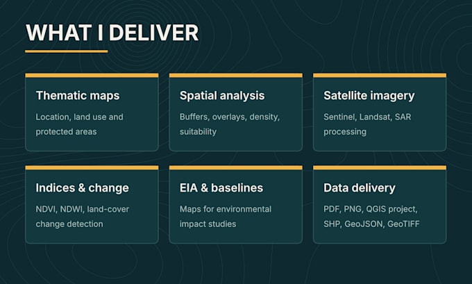
Ja. Ik kan shapefiles, geodatabases en GeoTIFF-bestanden openen en data leveren in formaten die volledig compatibel zijn met ArcGIS. Het bewerkbare kaartproject wordt opgeleverd in QGIS (.qgz).
Welke satellietbeelden gebruik je?
Voornamelijk gratis beelden zoals Sentinel-1 (SAR), Sentinel-2 en Landsat, verwerkt in Google Earth Engine, SNAP of QGIS. Als je commerciële beelden hebt, kan ik daar ook mee werken.
Kan ik na levering nog wijzigingen aanvragen?
Ja. Elk pakket bevat revisies, en je kunt extra revisies toevoegen indien nodig. Wijzigingen die de oorspronkelijke scope wijzigen, kunnen een offerte op maat vereisen.
Werk je aan grote of maatwerkprojecten?
Ja. Stuur me voor het bestellen de details en ik stuur je een passende aanbieding.