Door categorieën bladeren
Ontdekken
Fiverr Pro
Nederlands
$
USD

Level 2


Automatische vertaling
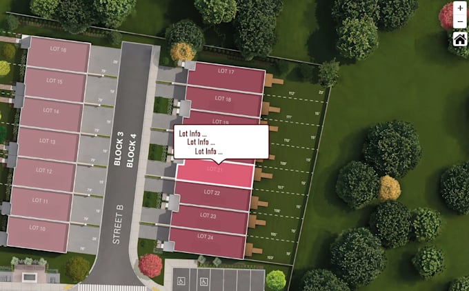
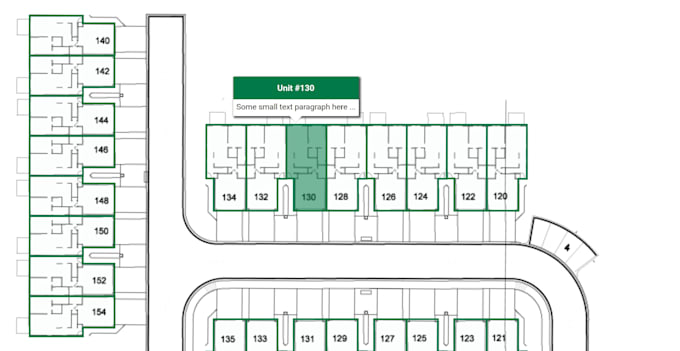
Ik maak van jouw plattegrond een volledig interactieve kaart voor je website of app.
Technologieën:
Wat je krijgt:
I develop interactive maps for various needs
Level 2
Talen
Automatische vertaling
Automatische vertaling
Wat heb je nodig om het project te starten?
Ik heb jouw plattegrond nodig (PDF, afbeelding of CAD-bestand) en een korte beschrijving van wat interactief moet zijn (klikbare gebieden, pop-ups, links, etc.).
Welke bestandsformaten accepteert u?
Ik kan werken met PDF, JPG, PNG, SVG, DWG, DXF, of zelfs handgetekende schetsen.
Wat krijg ik uiteindelijk?
Je krijgt een volledig interactieve plattegrond in HTML/SVG-formaat, klaar voor gebruik op je website
Kan ik dit in mijn website embedden?
Ja, de kaart kan eenvoudig worden ingebed in elke website met HTML of iframe.