Sommige informatie wordt in het Engels weergegeven.
Over mij
I am a GIS Analyst and Research Assistant with over 3 years of experience in remote sensing, spatial analysis, and environmental research.
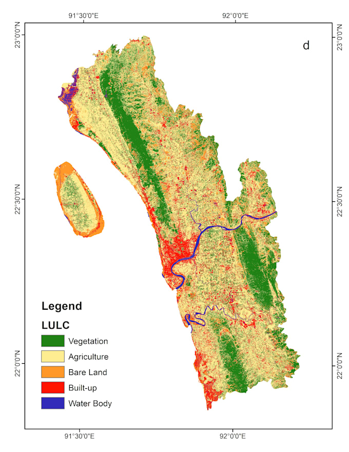
My expertise includes GIS mapping, land use and land cover analysis, carbon storage assessment, suitability analysis, and geospatial data visualization.
Proficient in ArcGIS, QGIS, and Google Earth Engine, I deliver accurate spatial analysis, high-quality maps, and research support for academic and professional projects. If you are looking for reliable GIS and research services, I am here to assist you.... Lees meer