If you are looking for Cartography, GIS Mapping, Spatial Analysis, and Remote Sensing Analysis, this is the right gig for you!
As an experienced GIS and Remote Sensing Analyst, I assure you that working with me will result in high-quality results with 100% customer satisfaction.
Services:
- GIS and Remote Sensing research, project works, report writing, presentation slides
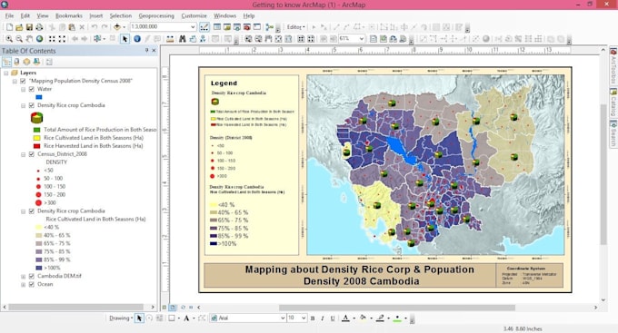
- Develop Professional Maps, Editing, Map digitization
- Projection system, Coordinates transformation
- Geo-referencing, Geocoding, GPS
- Geostatistical Analysis
- Creating Geodatabase, shapefiles, kml etc
- Conversion of data, Raster to Vector
- Data Extraction from Google Earth, Google Map and other sources
- Watershed Analysis
- Site suitability Analysis
- Accident Analysis and Hot Spot Analysis
- Interpolation
- Proximity, Overlay, Extract, Masking, or any 2d Analysis
- Spatiotemporal Analysis
- Landuse Landcover (LULC) Mapping
- Image Classification
- Image Layer Stacking, Mosaicking
- Satellite imagery or Aerial image processing
- Disaster/Hazard Mapping
and any other GIS and Remote Sensing work/task
Software:
Please contact me before placing order.
I look forward to working with you, let's talk! :)