Ik voer ruimtelijke digitalisering uit en maak kaarten en data

A
ashmita_gis
A
ashmita_gis
Ashmita Rijal
Sommige informatie is automatisch vertaald.

Over deze dienst

Automatische vertaling

<p Ben je op zoek naar nauwkeurige GIS-digitalisering en professionele kaartvoorbereiding?

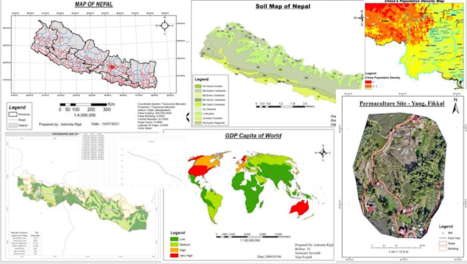
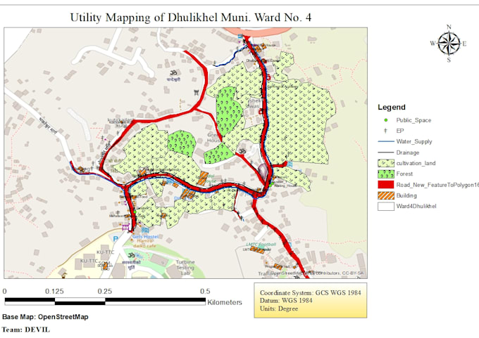
Hoi, ik ben Ashmita, een Geomatics Engineer gespecialiseerd in GIS, Remote Sensing en Cartografie. Ik digitaliseer kaarten van satellietbeelden, gescande tekeningen, gegeven punten of Google Earth en maak schone, goed ontworpen kaarten en ruimtelijke data klaar voor rapporten, onderzoek of presentaties.

Ik zorg voor nauwkeurigheid, juiste projectie, schone topologie en een professionele cartografische lay-out.

De diensten omvatten:

Digitalisering (punten, lijnen, polygonen)

Georeferentie

Kaartlay-out ontwerp

Thematische kaarten

Shapefile, GeoJSON, KML creatie

PDF/PNG/JPEG outputs

Maak kennis met Ashmita Rijal

Ashmita Rijal

Geomatics Engineer

  • Afkomstig uitNepal
  • Lid sindsfeb 2026
  • Talen

    Engels
Hi, I’m Ashmita, a Geomatics Engineer specializing in GIS, Remote Sensing, GNSS, and Drone Mapping. I help researchers, companies, and organizations transform spatial data into meaningful maps, analysis, and professional reports. My expertise includes GIS Mapping, Spatial Analysis, LULC classification, Satellite Image Processing (Sentinel, Landsat, MODIS), Change Detection, Drone and GNSS data processing (RTK, PPK, Static). With a strong geospatial background and engineering foundation, I focus on accuracy, clarity, and professional results. Let’s turn your spatial data into powerful insights.

Automatische vertaling