Door categorieën bladeren
Ontdekken
Fiverr Pro
Nederlands
$
USD

GIS and Remote Sensing Specialist, Spatial Analysis and Mapping Expert
Skills
Bekijk mijn diensten
GIS & Remote Sensing Project Analyst
Freelancing Career • Freelance
Dec 2021 - Present • 4 yrs 6 mos
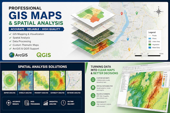
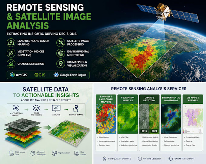
I work as a GIS and Remote Sensing freelancer, applying geospatial techniques to solve spatial and environmental problems. I specialize in spatial data analysis, remote sensing image processing, land use and land cover mapping, and geospatial data visualization. I regularly work with satellite imagery from Landsat and Sentinel datasets to perform classification, change detection, and environmental assessment. I integrate spatial datasets such as digital elevation models, soil data, and demographic data to support geospatial modeling and decision-making. I use ArcGIS Pro, ArcMap, QGIS, and Google Earth Engine to process spatial data, generate thematic maps, and develop clear geospatial outputs for analysis and reporting. My work focuses on delivering accurate, structured, and practical GIS solutions tailored to client needs across environmental studies, infrastructure planning, agriculture, and research-based applications.
