Door categorieën bladeren
Ontdekken
Fiverr Pro
Nederlands
$
USD

Vetted Pro
Top Rated
GIS Consultant, Spatial Analysis , ArcGIS , QGIS , Remote Sensing , Map Design
Prabhashini is geselecteerd door het team van Fiverr Pro vanwege diens expertise.
Gescreend voor
Datavisualisatie
Skills
Bekijk mijn diensten
Wil je op uurbasis werken?
Vertel Prabhashini wat je nodig hebt.
US$ 50
/
uurGIS Data Engineer
Fishbrain • Fulltime
Dec 2023 - Present • 2 yrs 6 mos
I contribute my expertise in GIS at Fishbrain by managing spatial databases and performing advanced geoprocessing using leading GIS software and database management systems. I provide consistent support to ensure users enjoy a high-quality, location-based experience within the app. My core technical strengths include QGIS, DBeaver, and PostgreSQL/PostGIS, along with advanced mapping and spatial analysis capabilities.
GIS Sepcialist
Lucytech • Fulltime
Dec 2023 - Present • 2 yrs 6 mos
At Lucytech, I serve as a GIS Specialist, leveraging advanced geospatial technologies to manage spatial databases, perform comprehensive geoprocessing, and develop accurate, insight-driven mapping outputs. I support data-driven decision-making by ensuring high-quality spatial data management and efficient GIS workflows. My key expertise includes QGIS, PostgreSQL/PostGIS, and DBeaver, alongside strong capabilities in spatial analysis and geospatial data visualization.
GIS Consultant
Map Aura • Freelance
Jan 2022 - Present • 4 yrs 5 mos
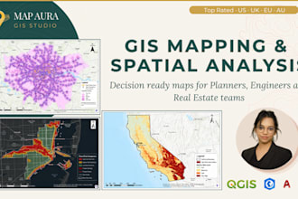
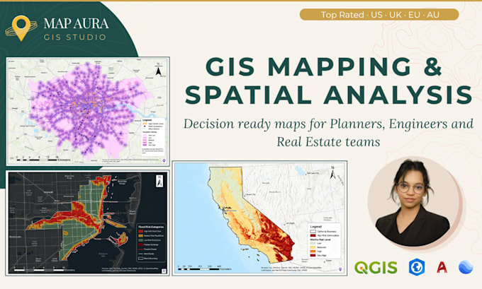
As a GIS Consultant at Map Aura, I partner closely with clients to turn geospatial challenges into clear, actionable solutions. I design and implement advanced GIS workflows tailored to project needs—ranging from spatial data engineering, geodatabase design, and data cleaning to complex spatial analysis, modeling, and automation. I work with high-accuracy datasets, remote sensing imagery, DEMs, and vector/raster data to deliver precise, insight-driven outputs such as thematic maps, spatial intelligence dashboards, decision-support maps, and professional print-ready cartography. Leveraging tools like QGIS, ArcGIS, PostGIS/PostgreSQL, Python for GIS automation, and modern remote sensing techniques, I ensure every project is technically robust, visually compelling, and aligned with real-world decision-making. My focus is always on delivering reliable results, clear communication, and long-term value for each client.
| (200) | ||
| (6) | ||
| (0) | ||
| (0) | ||
| (0) |

gabod2000
Terugkerende klant

Verenigde Staten
Hi Prabha, Thank you for the revised Lagos Island CBD baseline package. I reviewed the updated files, and this version looks acceptable for my pilot staging review. The CRS issue appears to be fixed. The GeoJSON, Shapefile, and KML layers now appear to be in EPSG:4326 / WGS84 longitude-latitude format,...
Reactie van de freelancer
bulling_de
Terugkerende klant

Duitsland
This was a challenging and highly detailed project, but Prabha handled it brilliantly. Her communication was clear and consistent, and her final delivery reflected a high level of expertise. I’d be glad to work with her again anytime.
Reactie van de freelancer
bulling_de
Terugkerende klant
Duitsland
Prabha’s work on our Historical Aerial Georeferencing assignment was beyond impressive. Every single map was delivered with remarkable precision and clarity. Her ability to manage a complex and long-term task while keeping communication open and timelines on track is something I truly value. She’s a rare find and an asset to any mapping project.
Reactie van de freelancer

tamaracarter622
Terugkerende klant
Verenigde Staten
She gave me exactly what I requested and delivered it earlier than promised. Had to do one revision, but it was a minor adjustment. Will definitely be working with her again on future projects.
Reactie van de freelancer