Sommige informatie wordt in het Engels weergegeven.
Over mij
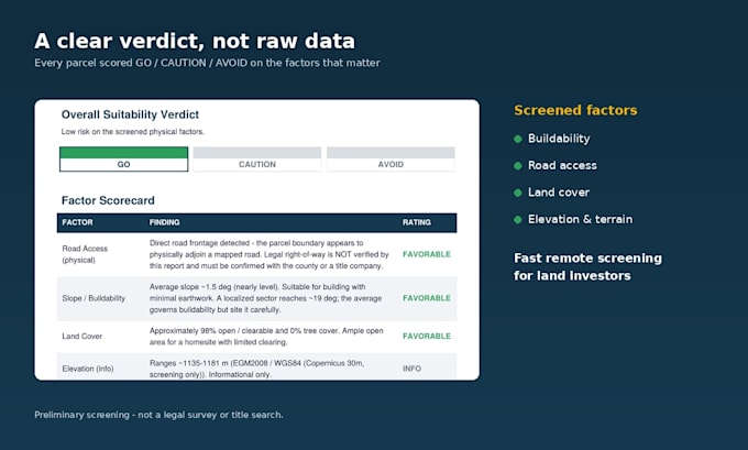
I help land investors and buyers understand a property before they commit. If you're buying vacant land you haven't visited, I turn public satellite and government data into a clear visual report — slope and buildability, road access, elevation, land cover and terrain — with a simple GO / CAUTION / AVOID verdict.
Trained in topography, geodesy and cartography, I focus on fast, easy-to-read screening for remote buyers.
Note: my reports are preliminary, data-based analyses for decision support — not legal surveys, title searches, or certified documents. Fast delivery and clear communication.
... Lees meer