Door categorieën bladeren
Ontdekken
Fiverr Pro
Nederlands
$
USD

GIS Specialist QGIS ArcGIS and Spatial Data Analysis Expert
Skills
Bekijk mijn diensten
Freelance GIS Analyst / Géomaticien
Freelance GIS Services • Freelance
Feb 2025 - Present • 1 yr 4 mos
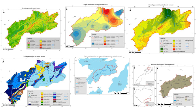
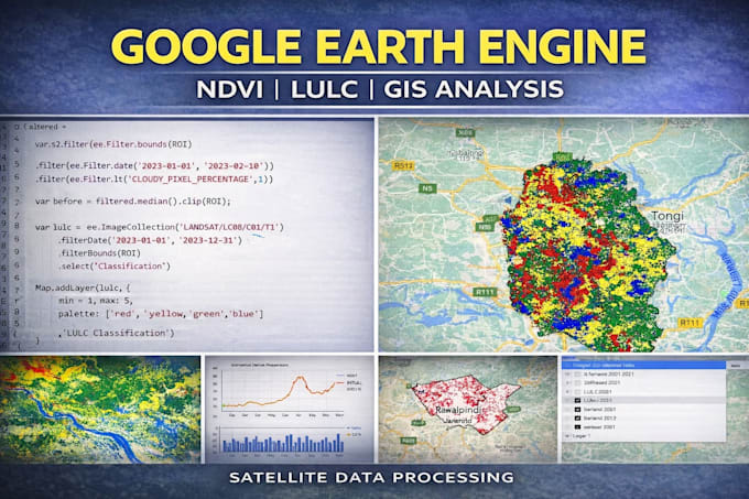
Réalisation de projets SIG pour des étudiants, chercheurs et organisations. Création de cartes professionnelles (GIS Mapping) avec QGIS et ArcGIS. Analyse spatiale et traitement de données géographiques pour différents projets environnementaux et territoriaux. Traitement et visualisation de données géospatiales provenant de diverses sources (shapefile, raster, données satellitaires). Production de cartes thématiques et d’analyses spatiales pour la prise de décision
Spécialiste SIG / Analyste GIS
Bureau d’Études – SIG et Analyse Spatiale • Parttime
Dec 2022 - Present • 3 yrs 6 mos
Participation à des projets d’analyse spatiale et de cartographie à l’aide des systèmes d’information géographique (SIG). Réalisation de cartes thématiques et traitement de données géospatiales avec QGIS et ArcGIS. Analyse spatiale pour l’aménagement du territoire et les études environnementales. Gestion et structuration de bases de données géographiques pour différents projets SIG. Production de visualisations cartographiques et de rapports techniques.
