Sommige informatie wordt in het Engels weergegeven.
Over mij
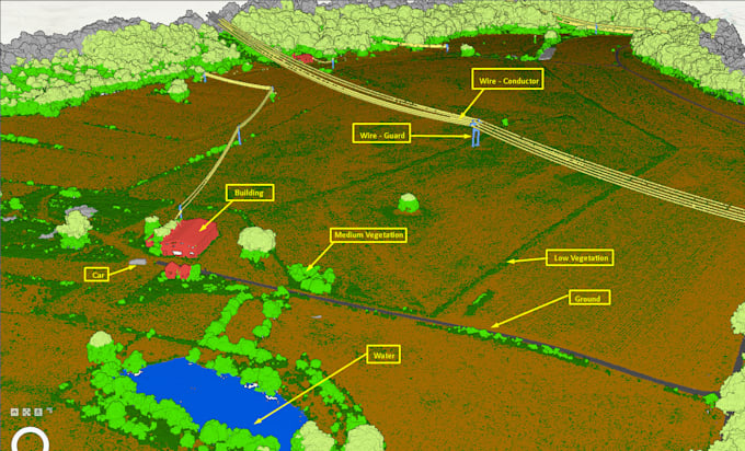
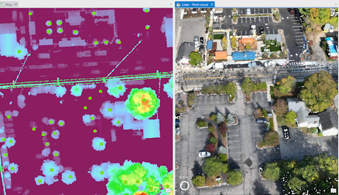
Hi, I’m Chung, a Geomatics Engineer with 5+ years of experience in UAV mapping, Scan-to-BIM, GIS, surveying, and point cloud processing (LiDAR, photogrammetry, laser scanning). I have worked on diverse projects including construction, industrial sites, roads, bridges, and complex terrains. Proficient in ArcGIS, QGIS, AutoCAD, Leica, Trimble, and photogrammetry tools, I deliver accurate mapping, georeferencing, digitization, and web GIS solutions. I specialize in turning spatial data into clear insights for planning, analysis, and decision-making.... Lees meer