Door categorieën bladeren
Nederlands
$
USD
Koppel je AI aan Fiverr
Level 1
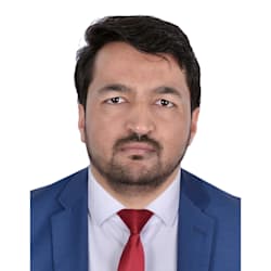
GIS Specialist, Python Programmer
Skills
Bekijk mijn diensten

Wil je op uurbasis werken?
Vertel Mumtaz A wat je nodig hebt.
US$ 25
/
uur
Sr GIS Analyst & Team Lead
TAQA Water Solutions • Fulltime
Jul 2024 - Mar 2026 • 1 yr 8 mos
Developed Python scripts to validate Asset ID correctness and spatial accuracy, streamlining GIS–Maximo integration and improving asset management reliability. Led and mentored the GIS team, ensuring delivery of high-quality spatial data solutions for water infrastructure projects. Oversaw QA/QC of GIS deliverables, detecting data gaps, improving consistency, and ensuring compliance with Abu Dhabi DMT standards. Conducted advanced spatial analyses and produced reports and maps, enabling strategic planning and informed decision-making. Conducted advanced spatial analyses and produced reports and maps, enabling strategic planning and informed decision-making. Managed enterprise GIS database operations, including versioning and synchronization, to maintain data integrity and enterprise-wide accessibility.

Sr GIS Analyst
Roads and Transport Authority • Fulltime
Dec 2022 - Jul 2024 • 1 yr 7 mos
Maintained and updated road and transport-related GIS layers (parking, road lighting, gates), ensuring timely and accurate spatial data availability. Collaborated with Parking Section teams to integrate survey data into the SDE database and perform QA/QC checks, improving accuracy and reliability of asset information. Coordinated with the Road & Facilities Maintenance (RFM) department to regularly update road lighting and traffic system layers, supporting effective infrastructure management. Executed complex data migrations from AutoCAD and MicroStation into enterprise GIS databases, streamlining asset data integration. Prepared GIS–Maximo integration sheets for newly created features, ensuring smooth asset management system updates. Developed Python-based QA/QC tools to automate validation and updating of GIS data, reducing manual effort and errors. Supported spatial analysis projects by contributing to the design and implementation of GIS solutions that improved transport planning and services. Collaborated with cross-functional teams to identify, develop, and implement innovative GIS workflows and solutions.

GIS Specialist
R2V • Fulltime
Jan 2022 - Aug 2022 • 7 mos
Monitored georeferencing tasks for the Digitization team and Data Entry Operators to ensure accurate and precise spatial data alignment. Compiled and managed GIS data from a variety of sources, including Computer-Aided Design (CAD), Geographical Information System (GIS), and Total Station, while overseeing the georeferencing efforts of the team. Migrated and performed data conversion from non-GIS sources to GIS formats, enhancing data compatibility and accessibility. Conducted various spatial analyses over time, including suitability analyses, overlay analysis, heatmaps, and interpolations, to support decision-making and planning processes. Produced dynamic and visually appealing maps to effectively communicate spatial data insights and findings.
| (36) | ||
| (2) | ||
| (1) | ||
| (0) | ||
| (0) |
jordanjtramp

Mexico
I’ve had the pleasure of working with Mumtaz for the past three years on an ambitious project: transforming AutoCAD survey drawings into fully interactive, clickable property maps, allowing customers to explore and select individual lots in a VR-style experience, similar to choosing seats on Ticketmaster,...
Reactie van de freelancer
jordanjtramp
Mexico
Always great to work with :)
Reactie van de freelancer
jordanjtramp
Mexico
I enjoyed working with mumtaz, he's a really cool guy, did great work, was fun to work with, and I think everything went to plan. We are still in the process to reach the final goal, and will update my review as we go :)

kryptosync

Verenigde Staten
Great programmer, handled my GIS project with ease.

shahbaz_alia

Pakistan


