Door categorieën bladeren
Ontdekken
Fiverr Pro
Nederlands
$
USD

GIS Analyst
Skills
Bekijk mijn diensten

Junior GIS Expert (1 October 2024 - 30 June 2026)
Urban Development Directorate (UDD) • Fulltime
Sep 2024 - Jun 2026 • 1 yr 9 mos
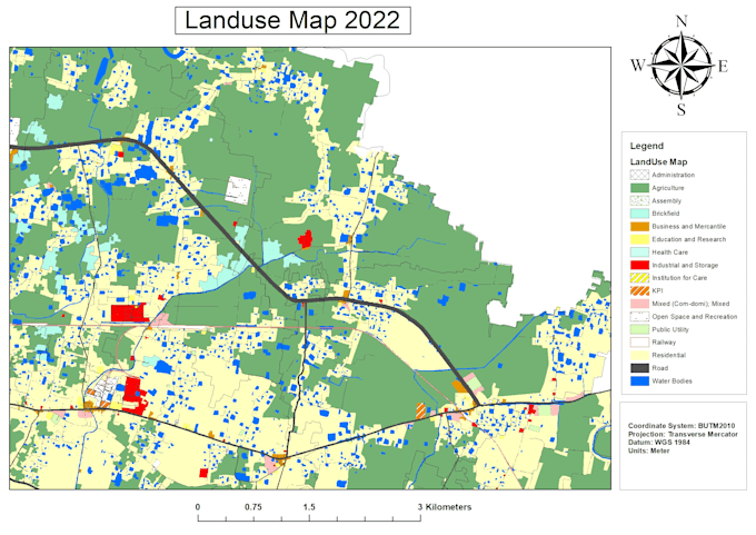
Project Name: Preparation of Development Plan for 3 Upazilas ( Pirojpur Sadar, Nesarabad and Nazirpur Upzilas ) of Pirojpur district Responsibility: • Assisted in preparing high-quality topographic, land use, physical feature, infrastructure, and other thematic maps using GIS and Remote Sensing techniques for urban and regional planning projects. • Developed, maintained, and managed spatial and attribute databases to support planning analysis, decision-making, and project implementation activities. • Performed spatial analysis, digitization, geo-referencing, data validation, and map updating to ensure accurate and reliable GIS outputs. • Supported the preparation of Draft Structure Plan, Urban Area Plan, Rural Area Plan, and Action Area Plan through GIS-based analysis and planning support. •Conducted open space calculations, land use assessments, and spatial evaluations following project requirements and planning standards. •Ensured quality control of GIS databases, maps, and technical deliverables by checking topology, data consistency, coordinate systems, and overall mapping accuracy. •Installed, configured, and troubleshot GIS software and related technical issues in both project and head office environments, ensuring smooth operational workflow. •Processed and analyzed spatial datasets, satellite imagery, and survey information for planning and development purposes. •Coordinated with planners, engineers, survey teams, and project officials to collect, organize, and integrate field and spatial data effectively. •Assisted senior experts and project management teams in delivering planning and GIS-related tasks within project deadlines. •Demonstrated strong analytical, problem-solving, database management, and mapping skills while handling multiple project responsibilities efficiently.
