Door categorieën bladeren
Ontdekken
Fiverr Pro
Nederlands
$
USD

GIS Speacialist
Skills
Bekijk mijn diensten
GIS Spacialist
Freelancer.com • Freelance
Dec 2023 - Present • 2 yrs 5 mos
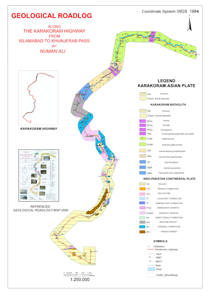
Population Density Mapping (Choropleth): Created a detailed Choropleth Map for FATA population distribution. Analyzed census data to visualize demographic shifts and density patterns using professional classification methods (Natural Breaks/Quantiles). Environmental Monitoring (AQI Index): Developed a Pakistan-wide Air Quality Index (AQI) Map. Used spatial interpolation techniques (like IDW/Kriging) to visualize pollution levels, helping to identify high-risk environmental zones. Geological Mapping Specialist: Successfully completed the digitization of the Karakoram Highway (KKH) Geological Roadlog. Expertly handled the conversion of legacy paper maps into high-precision digital datasets, focusing on tectonic boundaries (MMT, Raikot Fault).
