s
sha_dahar

Iffi

@sha_dahar

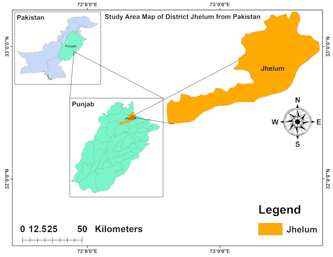
I can do any task on QGIS ArcGIS GEE RStudio

Pakistan
Engels
Sommige informatie wordt in het Engels weergegeven.
Over mij
Hi, I’m Muhammad Irfan, a Forestry graduate specializing in advanced GIS and Remote Sensing solutions for environmental and land-based projects. My expertise covers: • Land Use / Land Cover (LULC) classification using Sentinel & Landsat • NDVI and vegetation health analysis • Plant species and vegetation classification using machine learning techniques • DEM, slope, contour, and terrain analysis • 3D mapping and terrain visualization • Digital survey mapping and spatial data processing • Shapefile creation, digitization, and professional map design ... Lees meer

Skills

s
sha_dahar
Iffi
offline • 
Gemiddelde reactietijd: 13 uur

Bekijk mijn diensten

Formules en macro's
I will do advance mapping of vector data and spatial data also
Formules en macro's
I will do mapping for you of your aoi

Werkervaring

Job

Ministry of climate change • Fulltime

Sep 2025 - Jan 20264 mos

I have learn their digital survey on Qgis, satellites data processing and data analysis.